 |
||
| Home | Trail Maps | Rides | Contact | Signup | Video | Links | ||
| Trail Maps Here are some maps from members' rides in Northern California. If you have a favorite trail map you'd like to submit, send it on in! Be sure to include directions on how to get there, and why you like it. We can accept most any graphic file format, high-res JPG is best. If you are a GPS user, feel free to send a GPX file with any waypoints and your track. To view or download information below, for maps click the small map on the left to see a full-sized version. To download Google Earth kml files, right-click and choose "save file as". |
||
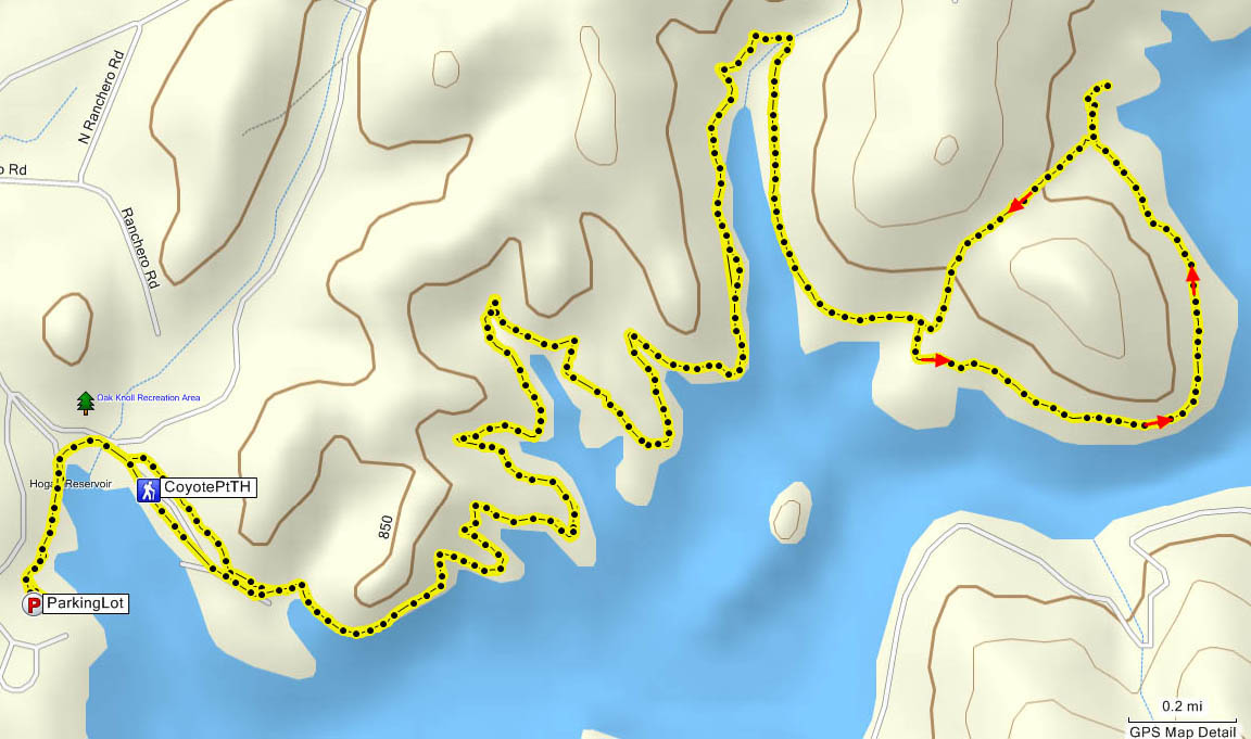 |
New Hogan / Coyote Point Trail Distance: 12+ miles New Hogan Reservoir is just outside Valley Springs near Hwy 26. Enter at the Oak Knoll Campground area, tell the attendant you are riding the bike trail. Park at the small lot just outside the gate, trailhead leaves from the gate. If Oak Knoll is closed, continue to the next parking lot on the left. Trail is out-and-back, the maps here show a slightly different return route.  MTB Guru profile MTB Guru profileCorps of Engineers site and their bike trail map |
||
 |
New Melones Lake / Glory Hole Area Distance: up to 15 miles NOTE: New Melones now charges a $6 "day use" fee to get in - this applies to everyone entering the gate. New Melones is just outside Angel's Camp near Hwy 49. Turn south on Whittle Ranch Road, enter the recreation area, and follow the main road down the hill, park at the Carson Creek Trailhead or turn right and drive to the Angel's Creek Boat Ramp. MTB Guru profile Ogre's write-up Ogre's write-upUS Dept of Interior site and a bike trail map |
||
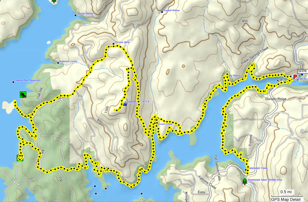 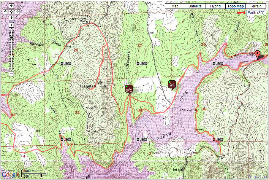 |
Salmon Falls Distance: more than 18 miles  South Fork American River extension now goes from Salmon Falls Bridge all the way to Cronin Ranch! Check out the trail map. South Fork American River extension now goes from Salmon Falls Bridge all the way to Cronin Ranch! Check out the trail map.Aka Darlington, Sweetwater nearby. Free parking south of the bridge, otherwise $8 lot on the north side at the trailhead. Salmon Falls is just outside El Dorado Hills in the Folsom Lake Recreation Area. From Hwy 50, go north on El Dorado Hills Blvd, it turns into Salmon Falls Road. About 10 miles north of 50, you'll reach the bridge. MTB Guru profile (extended version that goes 30 miles) Ogre's write-up |
||
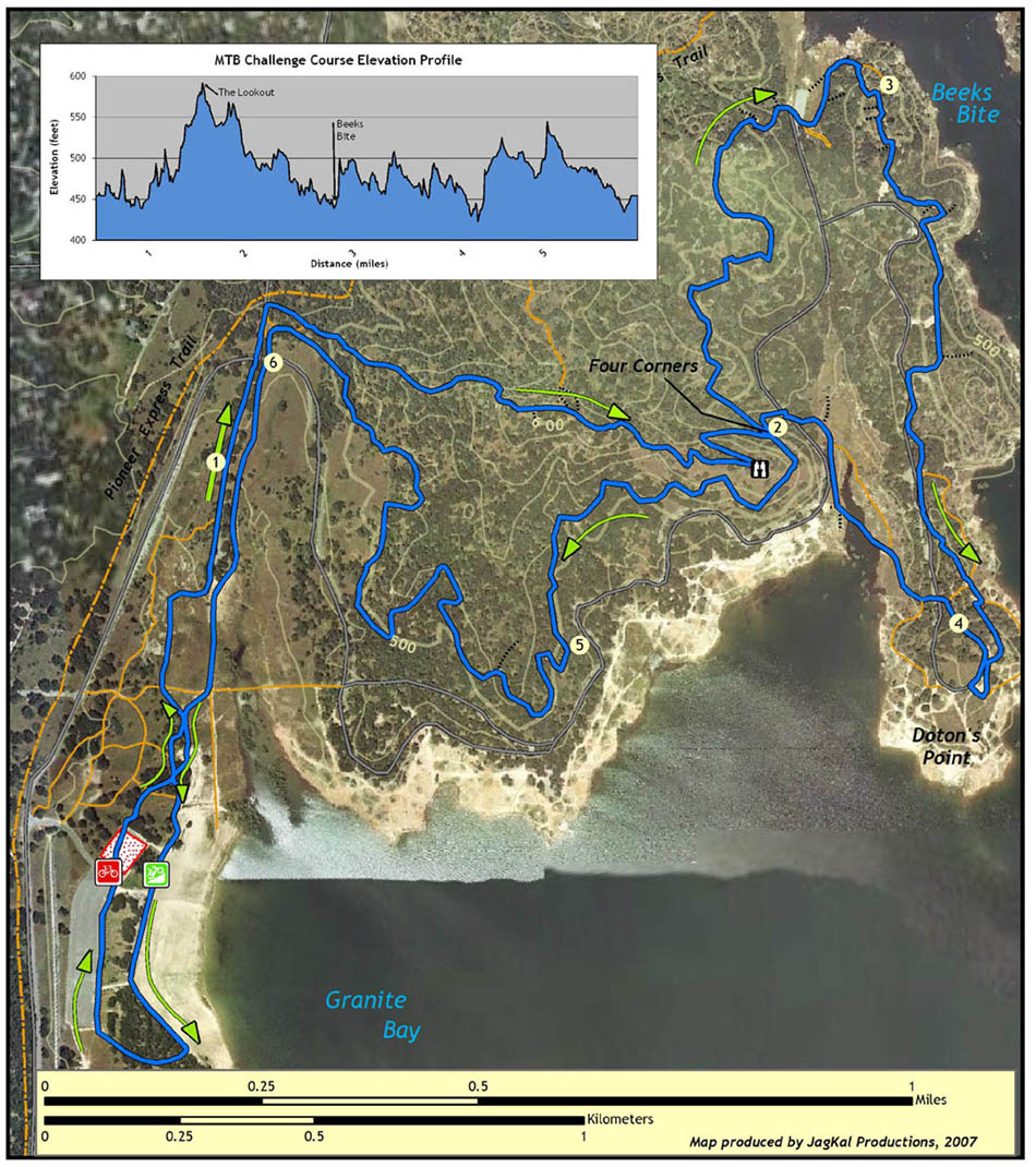 |
Granite Bay Distance: up to 22 miles Northwest side of Folsom Lake, very popular and scenic place to ride. They hold a couple of races here every year. There is a $5 day-use fee, a lot of people park outside the park and ride in.  California State park page MTB Guru profile Ogre's write-up California State park page MTB Guru profile Ogre's write-up |
||
 |
Olmstead Loop Distance: 12 mile loop Located in Cool, CA off Hwy 49, behind the fire house. There is plenty of parking at the trail sign. Recommended route is counter-clockwise, starting across the road from the fire house. Excellent write-up (download PDF) Ogre's write-up |
||
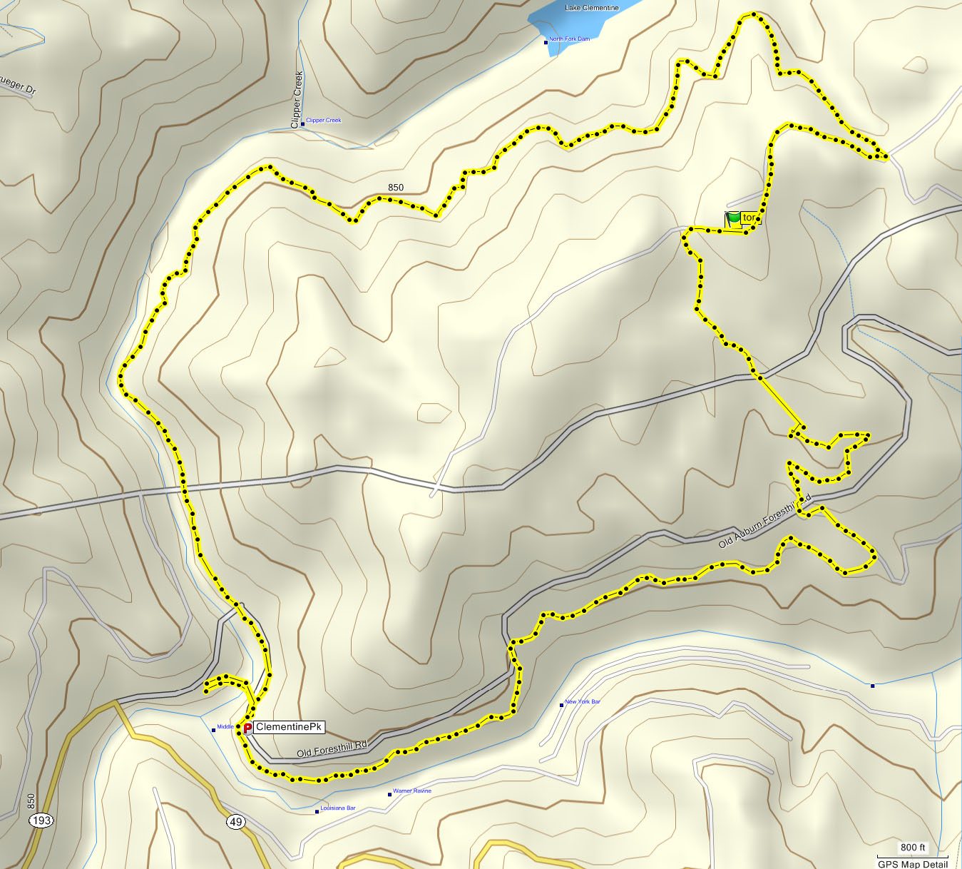 |
Clementine / Culvert Loop Distance: 7.3 miles Just outside Auburn, near the intersection of Old Forest Hill Road and Hwy 49. The loop runs south of Lake Clementine and near the confluence of the North and South Forks of the American River. Park on side of the road at N38 54.918 W121 02.152 or further west if full. MTB Guru profileClick for several other trails in the Auburn area |
||
 |
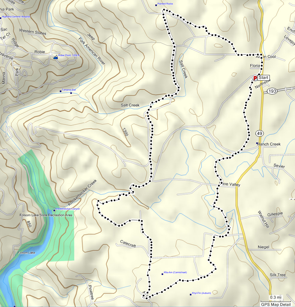
Connector to Foresthill Divide Loop Distance: 16.8 miles Just outside Auburn, near the intersection of Old Forest Hill Road and Hwy 49. The loop runs south of Lake Clementine and a little northeast of the Clementine Loop. Park at N38 55.977 W121 00.704 or on the roadside if full. If you have never ridden this loop, it would be a good idea to take someone who has. MTB Guru profileClick for several other trails in the Auburn area (jpg) Here's a GPX file of the ride. |
||
|
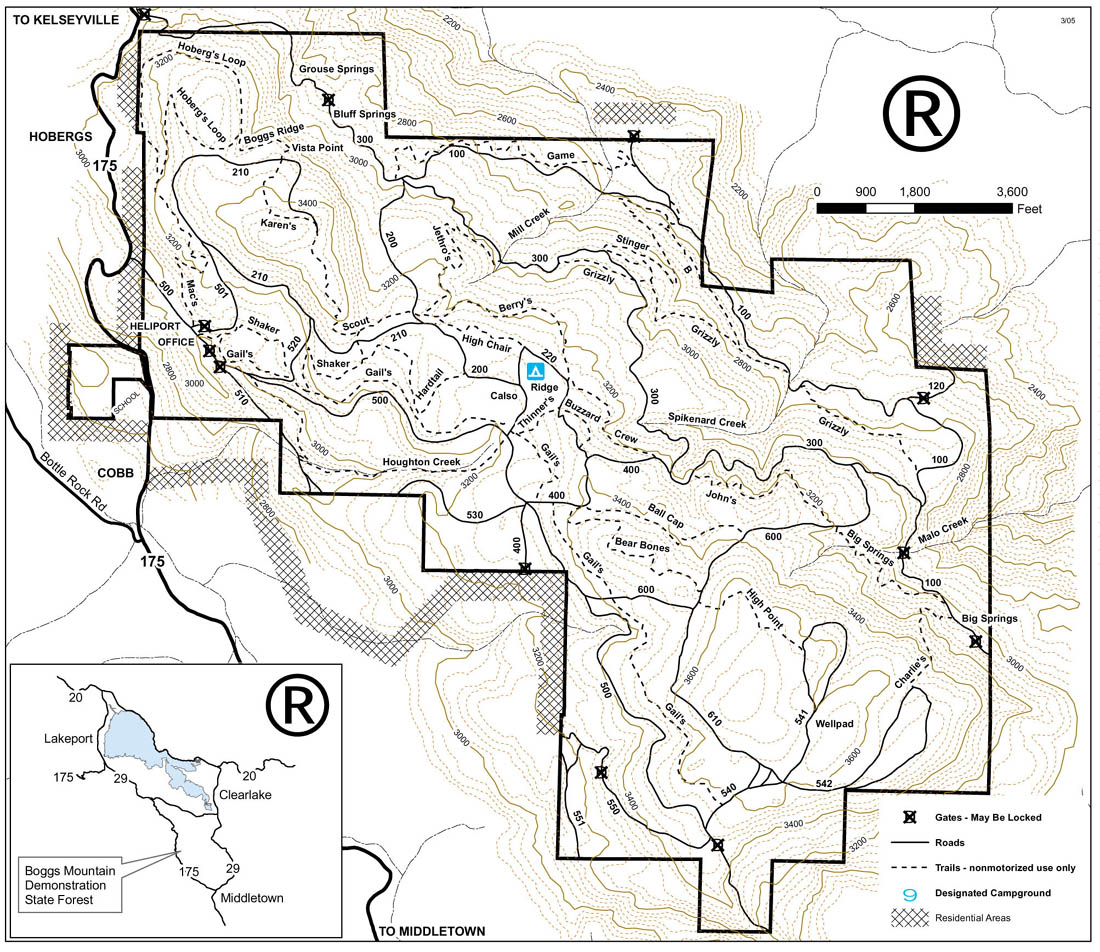
Boggs Mountain Distance: a lot Between Calistoga and Clear Lake, Boggs Mountain State Demonstration Forest has fantastic trails. There is something for everyone - fast narrow technical, fire road climbs, and rock gardens. Trails are well marked. Download PDF trail map. Campgrounds provide easy, immediate access to the single track. No reservations, first come first served. Go ride it! Ogre's write-up Cal Fire site Cal Fire site |
||
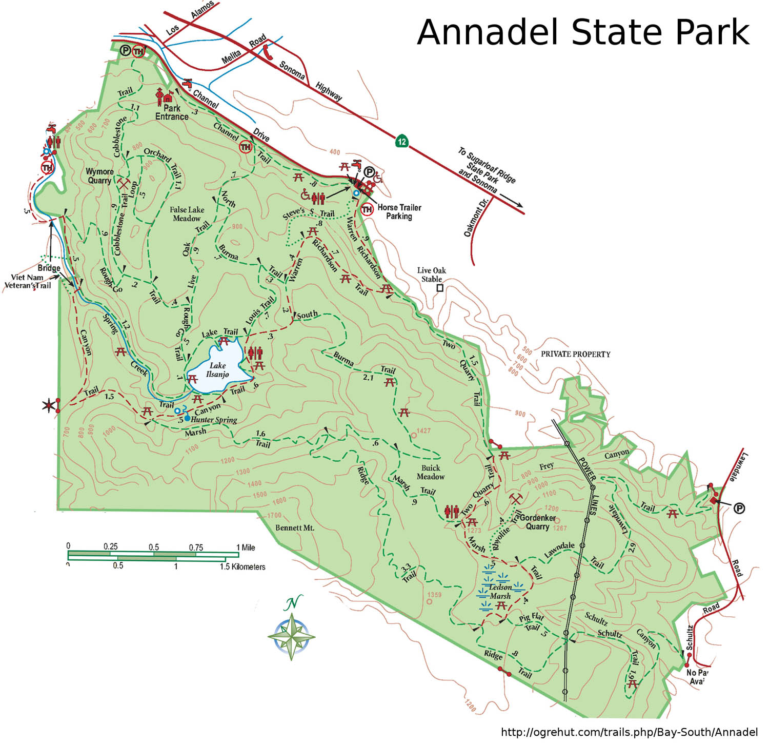 |
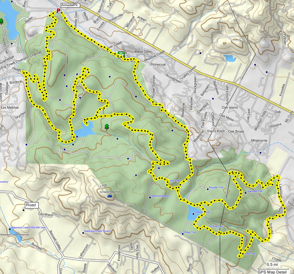
Annadel State Park Distance: up to 36 miles Near Santa Rosa off Hwy 12, Annadel State Park offers miles and miles of very well-marked trails. Download trail map here. Route as ridden was 24 miles, trails as follows (download trail map first): Channel -> W. Richardson -> Two Quarry -> Marsh -> Lawndale -> Schultz -> Pig Flat -> Marsh -> S. Burma -> Louis -> N. Burma -> Live Oak -> Rough Go -> Spring Creek -> Rough Go -> Cobblestone. Vertical profile of this route. MTB Guru profile Ogre's write-up California State site |
||
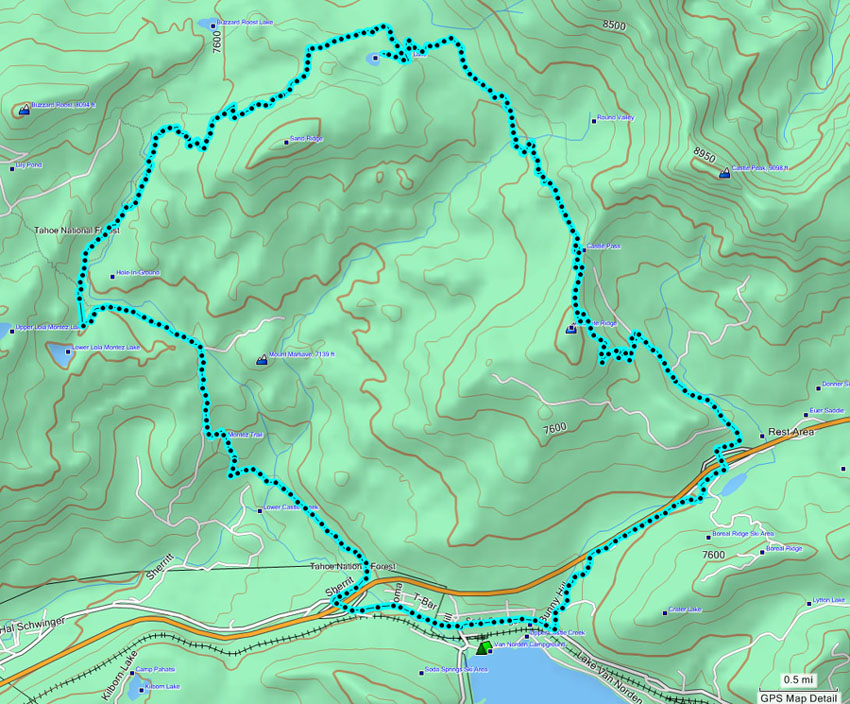 |
Hole in the Ground Distance: 18 miles Just off I-80, near Donner Summit, at the Soda Springs exit. Park on side of the road near Boreal Ski Area or on Sheritt Lane, north of the freeway and up the hill from the fire station. Not available in winter due to snow, starting elevation about 6,500 feet. MTB Guru profile Ogre's write-up |
||
 |
Ft. Ord (Monterey) Distance: tons BLM land, former military base right off Hwy 1 near Monterey, Ft. Ord has miles and miles of superbly maintained trails. Great local rider group MORCA - Monterey Off Road Cycling Association. Check out their trail page on their site. Nice folk and very organized. Ogre's write-up |
||
| Submit your favorite maps to cf@foothilltrailhounds.com. |
|||
| Updated: 11/19/2010 16:10 PST | |||